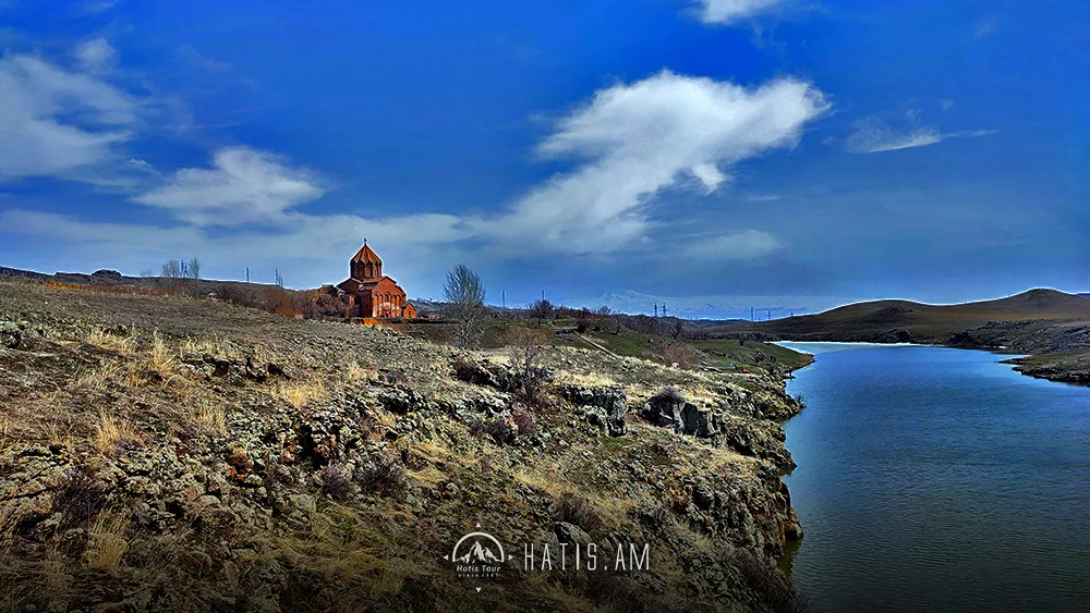
Armavir is a province (marz) in the western part of Armenia. Located in the Ararat plain dominated by Mount Ararat from the south and Mount Aragats from the north, the province’s capital is the town of Armavir while the largest city is Vagharshapat (Etchmiadzin). The province shares a 72 km (45 mi)-long border with Turkey to the south and west. The province is home to the spiritual centre of the Armenian nation, the Mother See of Holy Etchmiadzin of the Armenian Apostolic Church. It is the seat of the Catholicos of All Armenians.
Armavir Province
The province is named after the ancient city of Armavir founded in 331 BC. The province is also the site of the decisive Battle of Sardarabad in 1918 that resulted in the foundation of the Republic of Armenia. The battle is seen as a crucial historical event not only by stopping the Turkish advance into the rest of Armenia but also preventing the complete destruction of the Armenian nation. The Metsamor Nuclear Power Plant is also located in Amravir Province near the town of Metsamor. The Yerevan Zvartnots International Airport is located near the village of Parakar in Armavir Province (12 km (7 mi) west of Yerevan).
Etymology
The province is named after the ancient city of Armavir, one of the 13 historic capitals of Armenia. According to Movses Khorenatsi, ancient Armavir was built by Aramayis; the grandson of Hayk, who moved from Taron to the Ararat plain.
Geography
Armavir has an area of 1,242 km2 (4.2% of total area of Armenia) making it the smallest province of the country in terms of the total area. It is bordered by the Turkish provinces of Kars from the west and Iğdırfrom the south, with a length of 130.5 km bordrerline, where Aras River separates Armenia from Turkey. Domestically, it is bordered by Aragatsotn Province from the north, Ararat Province from the east and the capital Yerevan from the northeast. Historically, the current territory of the province mainly occupies the canton of Aragatsotn, along with small parts of Arsharunik and Masyatsotn cantons of the Ayrarat province of Ancient Armenia. The province is entirely located at the heart of the Ararat plain, mainly consisted of agricultural lands, with an average height of 850 meters above sea level, with some plains reaching up to 1,200 meters. Metsamor river (also known as Sevjur river) is the only river that originates from the province. The small lake of Ayger located near the Aknalichvillage, is among the few water surfaces of the province. Armavir Province is characterized with dry continental climate, with hot summers and mildly cold winters.
History
The territory of ancient Armavir was inhabited since the 5th millennium BC. Many sites including the Metsamor Castle, Shresh hill and Mokhrablur hill date back to the neolithic period. The ancient Urartian settlement of Argishtikhinili was founded in 776 BC by king Argishti I. One of the oldest written records about the region was found in the inscriptions left by the Urartian king Rusa II (685–645 BC). It is believed that the town of Vagharshapat was founded by king Rusa II in 685 BC as Kuarlini․ According to Movses Khorenatsi, the territories of modern-day Armavir Province mainly occupy the central part of the historic Ayrarat province at the centre of the Armenian Highland. It contains parts of the Aragatsotn canton along with small parts of the Arsharunik and Masyatsotn. The territory was among the most important regions of ancient Armenia since the Urartu period. Its strategic importance had significantly grown with the establishment of the Kingdom of Armenia in 331 BC by the Orontid Dynasty. 3 of the historic capital of Armenia are located in modern-day Armavir. The ancient city of Armavir became the capital in 331 BC until 210 BC. It was replaced by the nearby city of Yervandashat which remained the capital of the kingdom until 176 BC, under the reign of the Artaxiad dynasty. Between 120 and 330 AD, the capital of the kingdom was the city of Vagharshapat under the Arsacid dynasty. After the Christianization of Armenia in 301, Vagharshapat became the spiritual centre of the Armenians worldwide. In 405, Mesrop Mashtots introduced the newly created Armenian alphabet to the Armenians in Vagharshapat. After the fall of the Armenian Kingdom in 428, the region became part of the Sasanian Empire of Persia until the Arab conquest of Armenia in the mid-7th century. By the end of the 9th century, the region became part of the newly established Bagratid Kingdom of Armenia. Between the 11th and 15th centuries, the region suffered from the Seljuk, Mongol, Ag Qoyunlu and Kara Koyunluinvasions, respectively. However, the town of Vagharshapat restored its importance in 1441 when the seat of the Armenian Catholicosate was transferred from the Cilician city of Sis back to Etchmiadzin.
At the beginning of the 16th century, the territory of modern-day Armavir became part of the Erivan Beglarbegiwithin the Safavid Persia. During the first half of the 18th century, the territory became part of the Erivan Khanateunder the rule of the Afsharid dynasty and later under the Qajar dynasty of Persia. It remained under the Persian rule until 1827-1828, when Eastern Armenia was ceded by the Russian Empire as a result of the Russo-Persian War of 1826–28 and the signing of the Treaty of Turkmenchay. After the fall of the Russian Empire in 1917, the Ottoman Army intended to crush Armenia and seize the Russian Transcaucasia and the oil wells of Baku. In May 1918, the Ottoman forces attacked Eastern Armenia in 3 fronts. At the northern front, the Ottomans reached Karakilisa (nowadays Vanadzor) on May 20 almost without resistance. The 2nd front was through the town of Aparan while the 3rd and largest front was through the town of Sardarabad (nowadays Araks) in the Armavir region. On May 21, the detachment of Zihni Bey defeated an Armenian unit composed of 600 infantry and 250 cavalry, and then took over Sardarabad. Afterwards, the Ottoman forces advanced towards the village of Yeghegnut. The Armenian offensive led by Daniel Bek-Pirumian and Movses Silikyan was launched in 22 May. As a result of the decisive Armenian victories over the Turks on the 3 fronts of Sardarabad, Abaran, and Gharakilisa, the Armavir region became part of the independent Armenia by the end of May 1918. After 2 years of brief independence, Armenia became part of the Soviet Union in December 1920. From 1930 until 1995, modern-day Armavir was divided into 3 raions within the Armenian SSR: Baghramyan raion, Hoktemberyan raion, and Etchmiadzin raion. With the territorial administration reform of 1995, the 3 raions were merged to form the Armavir Province.
Population
According to the 2011 official census, Armavir has a population of 265,770 (130,078 men and 135,692 women), forming around 8.8% of the entire population of Armenia. The urban population is 85,050 (32%) and the rural is 180,720 (68%). The province has 3 urban and 94 rural communities. The largest urban community is the town of Vagharshapat (Etchmiadzin), with a population of 46,540. The other urban centres are Armavir and Metsamor. With a population of 5,584, the village of Parakar is the largest rural municipality of Armavir.
Photo By: Artur Martirosyan
The article is the property of hatis.am and it is forbidden to publish it without written permission. Partial or complete publication of the article can be done only by mentioning the source of the article or by actively linking to the website.
Leave a comment